Sunday, August 2, 2015

wrap-up

Three weeks later, we're mostly caught up on sleep deprivation and hygiene, every photo we've ever taken is on Facebook, we ordered prints of the good ones, Aaron got himself a job (!!), and today we finally put away the clean clothes from the trip and unpacked the rest of it. Like champs.

Gear:
Aaron has a High Sierra hydration pack; I borrowed a Deuter 28L daypack. It was more than enough space for what we needed for quick round-trip hikes. I don't want to give the Deuter back! Aaron carried the bulk of the immediate survival (water, bear spray, compass, knives) and I carried the extra clothes/rain gear, first aid kit, trail mix, phones/wallets/etc. It wasn't more than 10 pounds fully loaded, and we were really nicely balanced. As evidenced by how fast we booked it back down the Jenny Lake trail.

The tent, sleeping bag, lantern, and stove were all Coleman and like, 20 years old. Props to Coleman for having serviceable gear that is 20 years old. However, we gave it all away in Utah and Idaho. It's really heavy and bulky, and that is not okay for long trips or backpacking (which we'd like to eventually work up to). Modern camping gear is much more durable, smaller, and lighter.

Garmin Nuvi was a little drunk sometimes, but more or less got us where we needed to go. We confused her a lot in the mountains and desert. She tried to run us up the middle of nowhere on some dark, wet mountain in Colorado only once.

Rand McNally 2015 large-print road atlas was probably our biggest and most valuable navigational aid. We had state road maps for every state, but that atlas was just excellent. I think we used it more than the GPS in some parts.

America the Beautiful Access Pass was $80 and got us into every park free, no matter how many times we went in and out. Given our two entrances into Yellowstone and Grand Teton at $30 plus RMNP, it more than paid for itself. And somehow, while it's not technically supposed to, it also got us half off on all of our camping sites. More than paid for itself. Great little card. It's good for a year!

Darn Tough wool socks deserve every bit of praise anyone's ever sung about them. My feet were warm and dry no matter what I did to them, from Yellowstone steam to Rocky Mountain muddy tundra in the rain. We freaking love them. Go get some. They have a lifetime warranty!

My Merrell hiking shoes were badass and after a first hike to correct my pronation issues (thanks, sprained ankle), felt fantastic. No blisters, no soreness. They gripped their way up Ensign Peak and they even picked up trash on concrete. Aaron had Gander Mountain brand shoes, and he liked them about as much. Good shoes.

Clothing: WOOL CAPS were the best and we wore them almost constantly in Colorado. Ballcaps to keep rain off glasses. Water-resistant outer clothing. Leggings/compression shorts. Dri-fit inner clothing. And a big hoodie for coziness's sake.

Phones: T-Mobile and Sprint get absolute shit non-existent coverage past the Mississippi River. Screw that; we're switching to Verizon as soon as Aaron's contract expires in the next 30 days. Verizon gets much better service.


Lists:

Stuff We Forgot
  1. Aaron's clip-on sunglasses (but it rained the whole time, so moot point)
  2. Napkins (rectified at next fast food stop)
  3. Coozies
  4. Clips for closing snack food bags
  5. Laundry bag (got one from his mom) 
  6. Batteries for the big lantern
Stuff We Want For Next Time
  1. Canopy for over the picnic table/grill
  2. Better bedding in general 
  3. Good-quality lanterns
  4. Microfiber towels
Lessons Learned
  1. Aaron learned how to gear shift on mountains in an automatic transmission!
  2. TEST YOUR STUFF BEFORE YOU LEAVE
  3. The crap on the Grand Teton website about campsite reservations is a lie. Check Xanterra for reservations. Or sleep in Jackson, because there aren't a lot of woods for sleepin' in. Somehow.
  4. We actually function really, really, really well at about 6000-7000 feet ASL. We were rolling.
  5. Yellowstone is just Disney World and Old Faithful is Mickey Mouse.
  6. Idaho wants you to die and DOES get tornadoes.
  7. The campground at Craters of the Moon is open again!
  8. Paracord makes for a great laundry line when your stuff is soaked.
  9. Do not sleep in Kia Souls.
  10. Don't go out west during a strong El Nino.
License Plates We DIDN'T See
  1. Connecticut
  2. Hawaii
  3. Rhode Island
  4. Vermont
Bonus Plates
  1. Ontario
  2. Saskatchewan
  3. Alberta
  4. British Columbia
Animals Seen
  1. Elk, male and female
  2. Marmot
  3. Rabbit
  4. Squirrel
  5. Moose (female)
  6. Pika
  7. Bison (deeeefinitely male)
  8. Beaver
  9. Fox
  10. Enormous raven
  11. Owls
  12. Northern harrier
  13. Osprey
  14. Bald eagle
Rain-Canceled Plans 
  1. Great Smoky Mountain National Park hike (too wet for the scramble)
  2. Bridal Veil Falls (RMNP)
  3. Fairy Falls (YNP)
  4. Death Canyon (GTNP)
  5. Snowy Range scenic drive (Wyoming; it was under a mudslide and flash flood advisory)
  6. Craters of the Moon hike (ID)
  7. City of Rocks climbing (ID)

Bonus story: that time that a janitor at the Missouri welcome center asked if I would participate in the naked bike race, because I really should.


So with all that done... it's time to start working on 2016! :D We have to replace some gear over the year. Since El Nino will, in all likelihood, still be going by spring 2016, we are probably, most likely, going northeast, to Shenandoah NP and up the Appalachian Trail, basically. Niagara, upstate NY, New Hampshire and Vermont, and Acadia NP in Maine. Plan B is the Pacific Northwest to Montana, but that is a little harder logistically and a lot more expensive.

Whee! Thanks for reading!

Saturday, July 18, 2015

Day Eleven + Twelve

We don't wake up early in hotel rooms. We get up for free breakfast, go back to sleep, and stagger out just before mandated check-out. Camp sites, we're gone super early. I wonder what the difference is.

But Utah!

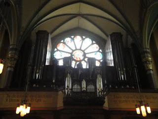
I drove us down to Salt Lake City, weaving through actual traffic (holy crap, people!) and billboards until we had a spot in a parking garage near Temple Square. We walked around that, taking a zillion pictures, and we had our own personal tour of the Conference Center. I got to see the massive organ! With like... seven thousand pipes, I think. Crazy. It's really beautiful, with a lot of thought and effort and creative engineering. There's a three-acre fountain garden on the roof.

After Temple Square, and a brief directional mishap, we walked to the Cathedral of the Madeleine. I'm not practicing Catholic anymore, but I would go to Mass there in a heartbeat. Even Aaron wants to. It's a beautiful cathedral, and even a dropped piece of paper echoes. I love cathedrals. I love how they're open, I love how they're old-style, I love how even the homeless are welcome to hide inside from the desert sun. It was totally worth the uphill walk.

After some planning, we drove down to a southern suburb to visit one of Aaron's high school friends, who graciously loaned us her driveway to repack for the airport (and also took our leftover food that we didn't want to bring back, and things like charcoal and lighter fluid). Her two little boys "helped." It was five by time we finished, so we had to head out. She gave us directions to Deseret Ministries (see: Goodwill) to drop off our unwanted camping gear and a burger joint she liked, and off we went to get a final tank of gas and eat something for the... uh, first time since breakfast. I was crashing so hard (also disappointed, because this whole time I had just wanted a sunny mountain climb and our plane took off in six hours). Aaron almost took the keys from me. Chubby's was delicious, and we took my leftovers with us.

This is the Place Monument was closed by the time we got back into Salt Lake City, but Ensign Peak Park wasn't! There was some steep driving up to the park itself, through neighborhoods that must be atrocious in the winter, but voila, a park! With a mountain! And trails! And religious history significance! It's second to the Monument, but works the same. So off we went.

Disclaimer: We're dumb.

We walked up to the first lookout point, and saw a broken-down wire fence and some stripped placards that had once blocked off a trail. Presuming the trail open, we looked up the face of the scrub-grass-covered mountain and said, oh, sure, let's go! So, dumbly, we plowed on, only making it up the incline because of our awesome hiking shoes. (Mine grip so well they literally pick up trash on tile floors.)

Maybe a little past halfway up, I was wheezing and missing my inhaler. There was a rock face that looked like maybe if I climbed up/through the rocks, I could get over the worst without the miserable switchbacks. Aaron took the switchbacks. So I went scrambling up the rocks (and had a great time, don't get me wrong) and took pictures of my view. Then went back down the rocks, because of course they didn't lead over the top, like a crab because my legs were too weak to manage a 45-60 degree slope. I slid down some like a slide. It was fun. Back on the hill, I pulled my phone out of my sports bra and called Aaron. Because while on my rock, I had seen some people moseying up a sidewalk of all things on the other side.

"Hey, is there an easy trail back down on the other side?"
"Yes. Yes there is."

Cue cursing. I promised to see him... whenever I got all the way up. Cue climbing on all fours, because walking like a bipedal human led to slipping on loose rock, and actual... you know, mountain climbing. Testing hand and footholds, planning routes, praying not to fall down the damn mountain, climbing over rocks. I was hot and tired and had to stop every 15 feet to catch my breath (yay desert altitude!) and it was AWESOME. It was pretty much vertical by the end.

Aaron met me at the last 20 feet or so and led me somewhere I could sit down and wheeze in triumph. I figured out how to take panoramic photos on my phone and we looked around at the lake, at the valley, found the Temple, everything. Everything I had wanted.

Then came the walk back down, which was steep but so doable that people were running it and carrying kids, and our legs shook the whole time, but then we were back at our car and I checked my running app for the mileage, calories, and elevation profile.

WE'RE LEGIT, Y'ALL.

1.01 miles, 465 calories, one hour, 4500 feet to 5300 feet.

We were out of breath and chugging water all the way to the carwash (poor Banana, she was filthy) and all the way to the airport.

At the airport, we had no problems returning the rental car (with 3910 new miles--heck yes unlimited miles) and began the fun process of checking in and checking baggage. We had to redistribute some weight, but got everything through. I changed clothes and we sat around finishing the burger leftovers, drinking all of our remaining water, and playing on our phones. When the security line went back to near nothing, we got in line.

Whereupon I looked at my boarding passes and they had my married name. I have not changed my name yet. The only thing I have in that name is a debit card.

Why hello there, TSA!

We had a lovely TSA supervisor who called the TSA HQ or whatever and confirmed that I wasn't on any no-fly lists, I guess, validated my boarding passes, and we got through security with no further delays. It was only 20 minutes. Aaron apologized profusely. TSA lady was just like, "so how long have you two been married?" I'm pretty sure they've dealt with worse.

Our plane took off at 12:15. I read fascinating things about the Cascadia fault and confirmed that Charleston has better seismic and flood codes than the entire state of Oregon and I'm never living there. As soon as we were boarded, Aaron force-fed me Benadryl because the dust from our climb was violently expelling itself and I apparently looked and sounded like crap. I watched the midwest lightning storms from the plane for a wonderfully drugged four hours (and slept for most of it). We had a sleepy hour-long layover in Charlotte, and got to Charleston around 8:30. I found my car, paid the $96 for leaving it in the lot, picked up Aaron with only one sympathetic scolding from airport security (no waiting in the loading zone!), used a wedding gift card to get Taco Bell breakfast, and we went home and promptly slept for seven hours. Lena wasn't even mad. She's been clingy and cuddly ever since, actually.

Sweet, humid, sea-level, secure building, home.

(Pictures again out of order.)

View from halfway up Ensign Peak.

Very center, that blob is Aaron.

View looking straight down from my rock perch.

From the top! That's the Great Salt Lake and the islands out there.

Find the Temple!

Wasatch Range, I am coming back for you.

As promised, I pushed Aaron down a mountain.

Big beautiful house, and behind it, Ensign Peak and the monument on top.

The first and only sunset we ever really saw.

ILU, Utah mountains.


First view of the Temple.


From the visitor center: a scale model of the Temple, with the actual Temple reflection overlaid. (Aaron is super proud of this photo.)

Model of the Temple interior, and a woman who demanded on being in every photo thereof.

Meeting building (I think?)


Fountain inside the Conference Center.

Conference Center.

Organ!

View from the Conference Center roof.

On the roof.

Cathedral.


Day Ten

After a nice hotel breakfast, we packed up and headed out. It was sunny! GASP.

Our first stop was Minidoka "War Relocation" Camp. This is a delightful euphemism for concentration camp. Most of it is gone, leaving only the foundations of two buildings and a replica guard tower, but care has been taken to preserve what's left, and there's some good signage remaining. The sunny desert morning was much appreciated as we peeked around. Not unlike Earthquake Lake, it was pretty somber, even surrounded by blue skies, a river, and sleepy cows.

Cumulus clouds were puffing up as we got back in the car. I don't trust you, clouds.

The Hagerman Fossil Beds were nearby, some dozen miles away, so we headed down some sketchy farm roads that way. We didn't really go into the dig sites, even with the promised Oregon Trail ruts. Some gravel roads and a one-lane bridge were required, and we were getting nervous with the rental car after Wyoming and Montana. We did see the fossils on display and the awesome interpretive site for Minidoka in the same building, collected our stamps, and had a nice, sunny picnic lunch at a park a block away. Hooray, peanut butter and jelly!

After that, and a break at the park bathrooms that featured a sticker warning us, brothers and sisters in Christ, TURN OR BURN, we headed into Boise. Idaho is really... uninspiring? Somehow, it's nothing like Wyoming at all, or at least none of it that we've seen. (I got so excited and nostalgic and desperate when I saw the Idaho side of the Tetons, even with the perma-storm over Grand Teton. Bring me baaaack.) We saw a dozen tumbleweeds, and I took some pictures of the more interesting geology, but mostly... blah? Only one semi-grand vista the whole way to Boise.

Stopping at the Harts was fantastic. I was afraid it would be awkward, especially since we both probably looked liked we'd been on the road for 10 days, but they were warm and welcoming, and in true Mormon fashion, asked if we'd eaten lunch, declared our picnic inadequate, and voila, full buffet spread on the counter as soon as Sarah and the others got back from church. We regaled them with stories. We sat on the trampoline and talked to Sarah about big universities and I glared at the brewing storm clouds. I didn't want to leave. I wanted to hide in their big beautiful house. Aaron bravely plowed ahead. They sent us with cookies and prayers.

We passed through a gap in the storms, yet again, until we were southeast of Twin Falls again and the sun was setting. We stopped at a gas station, where I found a penny and Darth Tater shirts, and contrary to the weather forecasts, lightning flickered on the horizon.

I really can't explain the sheer despondency and despair I felt that whole drive. Aaron resolutely kept going, down two-lane, winding country roads following signs to City of Rocks. That was one of the originals on the itinerary, and we had both been looking forward to rocks we could actually climb without trampling some delicate ecosystem. The further into the southern Idaho desert we got, the nastier the lightning got over the nearby mountains, the more anxious I got trying to figure out how the hell we'd camp safely in a desert lightning storm, until Shinedown's Unity was playing (of all freaking things) and I had a Moment, we both got chills, and Aaron stopped in the middle of the abandoned farmland, headlights shining on the dust and crud blowing across the road in the increasing wind, and asked if I wanted to just go straight to Utah.

YES.

So we turned around. We booked it like a bat out of hell. The wind and the lightning got worse and worse, until we were on I-84 headed south with a bunch of truckers and Aaron saw in the rearview mirror what might have been freaking ball lightning.

NOPE NOPE NOPE OUT OF HERE WE HATE YOU TOO, IDAHO.

Seriously. When we take over, Idaho is given forcibly back to Canada. Happy birthday, Canada. Have some potatoes.

As we got deeper into Utah and out of the mountains, the weather cleared up. I was leaning my head against the window, and when I looked straight up and let my eyes adjust away from the glare of the headlights, I saw stars. More stars than I had ever seen on the trip, ever. Even that one night in Colorado, I only saw a handful. Let alone full constellations, let alone a brightly streaking shooting star. The relief was almost palpable. Utah, you are safe. Utah, you don't try to kill us. Utah, I think I have a glimpse of how the pioneers felt when they finally got to you.

We found a super cheap, super cute, motel in Tremonton, where I-84 merges with I-15 straight to Salt Lake City. We ate an MRE for dinner at 11:30 PM.

Good riddance, Idaho.


Minidoka internment/concentration/"war relocation" camp


IDAHO. In all its... Idaho-ness.

Examples of prejudice from the immigration board at the Minidoka interpretive site.

Paper cranes.

THE MORMON OCTOPUS.
"Honey, when were you going to tell me you had tentacles?"
"WELL..."

The Hagerman Horse.

The actual Hagerman fossil beds.

Idaho geology.


Again.

"OF ALL THE RAIN, why haven't we seen ONE RAINBOW?"
*feeble glimmers in the clouds*


I am 95% sure that's just a rain shaft.

Adorable hotel has adorable actual keys! I didn't steal this one.

Hagerman fossil.