Saturday, May 28, 2016

Day Five - WV, MD, PA, & NY

Tuesday, May 24

We covered a LOT of ground today. It was the longest day of the trip, rolling into our campground at 8:50pm with the last vestiges of daylight. However, you can see and hear Lake Ontario from our campsite, so there's that. And there are bunnies EVERYWHERE. We've seen at least five tonight. It's also the warmest night we've ever had while camping, at a balmy 65 degrees or so. The low tonight is supposed to be 55... which is still really warm, let's be honest. Our camp nights tend to be in the 40s.

We left our site around 10am (after mopping up the tent exterior, because it poured all night long) and moseyed through West Virginia highways and byways until Maryland, which took like 20 minutes, and then into Pennsylvania, which is like a particularly forested Kansas. It's really boring until you get to the New York border, then you get mountain highway that reminds me of 441 into the Smokeys and is a lot of fun. There's not a lot to say about Maryland or Pennsylvania. We saw one site featuring two jails and a wastewater treatment plant all crammed together. That was special. We stopped to get drinks and lunch and wash our dishes from the night before in a sink, and I found Surge at the attached gas station. So that was Maryland. Pennsylvania was just really boring. We went along I-99 by Altoona and College Station. Boring. Saw some nice horses?

Really, the most important part of today's drive, aside from the constant fighting with our ridiculous GPS named Susan, was that shortly after crossing into New York, we were playing with the XM radio and I was tired of the same five artists on Octane and the 90s station wasn't doing it for me anymore, so I asked Aaron to see if there was a boyband station or something. He found 2000s pop. It's full of Britney Spears and NSYNC and Eminem and Lil Jon and every single thing I listened to in high school and college, and I proceeded to sing myself hoarse. That is the most important part of today.

In New York we have also seen tons of Mennonites, vineyards, odd farm equipment, Seneca and Cayuga Lakes, more odd farm equipment, and AN ACTUAL AMISH GUY DRIVING A HORSE DOWN THE HIGHWAY AND WEARING A TOPHAT(?) AND FROWNING AT ME IN DISAPPROVAL. I LOVE HIM. HE IS MY SECOND FAVORITE PART OF TODAY.

The third part, obviously, would be that we can hear the waves on Lake Ontario from our tent. And I did a baller job of backing the SUV into our narrow, steep, cliffside campsite. (Fourth part.)

Today was a good day.

Tomorrow, we have to do chores on the way to Vermont. The SUV, Lapras, needs an oil change (we'll get reimbursed by Alamo at the counter later) and we need to do laundry. Probably do that in Rome.

New York is so weird, y'all. I have seen so much weird stuff here. It makes the south look reasonable.

West Virginia has some neat geology.

But mostly it looks like this.

Cute houses from WV to ME!

Twilight Lake Ontario.

Welcome to Maryland. Here are your detention centers.

Free of West Virginia!

Day Four - VA & WV

Monday, May 23

After waking up and screwing around on Katie's wifi and playing with her puppy, we headed off to McDonalds for breakfast, then off to Shenandoah National Park. It was another beautifully gothic day, dreary with low-hanging clouds obscuring the views and intermittant rain, which canceled  our plans to tackle the rock scramble at Bearfence. Every rock scramble we've ever attempted has been canceled by rain. Maybe we're not supposed to ever scramble.

The first place we stopped was at The Point overlook, where there's a little trail down to a rock outcropping that you can climb on. While taking photos there, we passed a group of Asians. They were poaching plants. I had just seen the Facebook post by the park about it being a problem and asking that any suspicious activity be reported, and when people are pulling plants out of the ground and saying "that's the wrong plant," I think that's out of the realm of suspicious and into Scooby Doo levels of Obvious. So we raced up the extremely steep dirt trail and barely missed identifying their vehicle, but had enough details that we could report them anyway.

As luck would have it, we ran into them again at the Byrd Visitor Center. One of the women pulling plants out of the ground was walking through the parking lot back to their vehicle. So we 'took a walk around the parking lot to stretch our legs,' then promptly went and reported their vehicle description, occupant description, and tag numbers. It was a bit of an adrenaline rush. We got our passport stamped, got some trail recs, and headed off to hike our waterfalls. All the while we cackled over our new calling in life: tattling on people. Park Narcs, coming to TruTV this fall.

Today's trail was the Rose River-Dark Hollow Falls loop, which features two 70-foot waterfalls over four miles. It was probably the best trail we've ever hiked, competing pretty hard with the Jenny Lake/Inspiration Point trail in Grand Teton National Park. It was technically challenging without a whole bunch of self-loathing (like yesterday's), long enough to be a workout without taking a whole day, and we followed whitewater for about half of it. It started as a horse trail, then a rocky, narrow trail built into the bank alongside the river (downhill... and down... and down...), leveled out into something downright pleasant, and then slowly made itself back up steeper and steeper until reaching Dark Hollow Falls. Then it's all graded, flat, easy fire road back to the trailhead, so a really great cooldown. Around the point we started going uphill, the rain began in earnest. We were dressed for it, so that was fine, and then the thunder started. We were below the treeline and miles from buildings, so we just kept going.

First I pushed up my sleeves. Then I took off the thin, sweat-wicking long-sleeve shirt. Then I was just sweaty enough that I might as well get wet, so I took off the rain jacket too, just in time to reach the fire road and the falls. We were leapfrogging this family of four and I felt bad for them because every time they saw us, I was taking off some article of clothing. Oh well. It was 55 degrees, but we were so sweaty and hot from the work of climbing almost 1000 feet in the rain, through a trail so wet it saturated past my hiking boots and wool socks, the cool air felt GREAT. We got a lot of amazing photos on that hike.

With the hike done, and stuffing my face with homemade trail mix and water, we headed out of the park and toward West Virginia. The towns in western Virginia are really cute. Then you hit the mountain that is the border between Virginia and West Virginia (via US 33). The trip over Shenandoah Mountain, however, is like 10 miles of narrow, two-lane road and 9% grade up and down. It. Took. FOREVER. West Virginia makes you work for it.

Almost all of WV was like that, honestly. The moments I got to actually go 55 were magical. And yeah, West Virginia is basically a living stereotype. I saw at least one outhouse.

Our campground tonight is Seneca Shadows, with a beautiful view of Seneca Rocks. This is the nicest campground I've ever been to. It's manicured, landscaped, gorgeous, and a teacher taking a bunch of high schoolers backpacking invited us over for their extra cheeseburgers. Our immediate neighbors are metal heads. We saw two rainbows over the Rocks.  And I found a penny on our tentpad.

Shortly before becoming Park Narcs.

Our trail in Shenandoah had so much pretty water!


Rainbow over Seneca Rocks and our campground in West Virginia.

WV home rainy home.

Sunday, May 22, 2016

Day Three - VA

Sunday, May 22

We woke up this morning at 9am, which is actually pretty late for us while camping. The rain had stopped and it was sunny... with a good 30mph wind roaring through the trees. Which meant, along with the rain the night before, no hot breakfast. Lame.

Today's mission was to get through the rest of the Blue Ridge Parkway. It reminded us a lot of Yellowstone. I expected a bison to randomly appear on the road. There's almost no one else on the road right now since it's so early in the season. We had to detour near Peaks of Otter due to road construction, but the detour brought us to a McDonalds where I could satiate my McGriddle craving.

We stopped at Apple Orchard Falls because it was "just a short mile-long hike to the falls" and it was actually 3 miles roundtrip, with about 700 feet of elevation change. We went down first, to the base of the falls. Then up. That last part sucked. And the last third of a mile was ducking rain showers. (But there were two creek crossings and YAY I LOVE WATER.) I don't think we did the whole thing, because there were no 100+ stairs and the falls we saw were like, 10 feet, and definitely not 200 feet. Oh well. We regret nothing. It was good enough as it was and I really, really hate stairs.

Someone also fell and died at the main falls two months ago, so we'll call it even.

But we got some great pictures! And it was very much needed. We were both in odd moods and I guess still very stressed out, because we didn't snap back to 'normal' until we had done some heavy sweating in hauling ourselves back up that muddy trail.

The rest of the drive went pretty well. We saw a lot of rain in the distance, but never had to drive through it. It is not a fast or efficient drive, though. Not at 35-45 mph max. Gorgeous views and I enjoyed the different environments. Lots of trees and colors that we don't see in South Carolina.

At mile zero, the road changes to the Skyline Drive, which is the entrance to Shenandoah National Park. That is for tomorrow. Tonight, we drove into Charlottesville to meet some friends of mine for tasty Chinese and to sleep on their air mattress, which has a ROOF OVERHEAD and a SHOWER and a PUPPY (who is afraid of me but loves Aaron).  

Aaron also got a really questionable fortune cookie and took a picture of it overlaid on my face while I have chipmunk cheeks full of food, then posted it on Facebook and now people are asking if I'm pregnant. So there's that.

Tomorrow, we enter and camp in West Virginia, so if you never hear back from us again, start searching around Seneca Rocks and listen for the X-Files theme.


How today started: a little cloudy and hazy, a lot windy.

Then the sun came out!


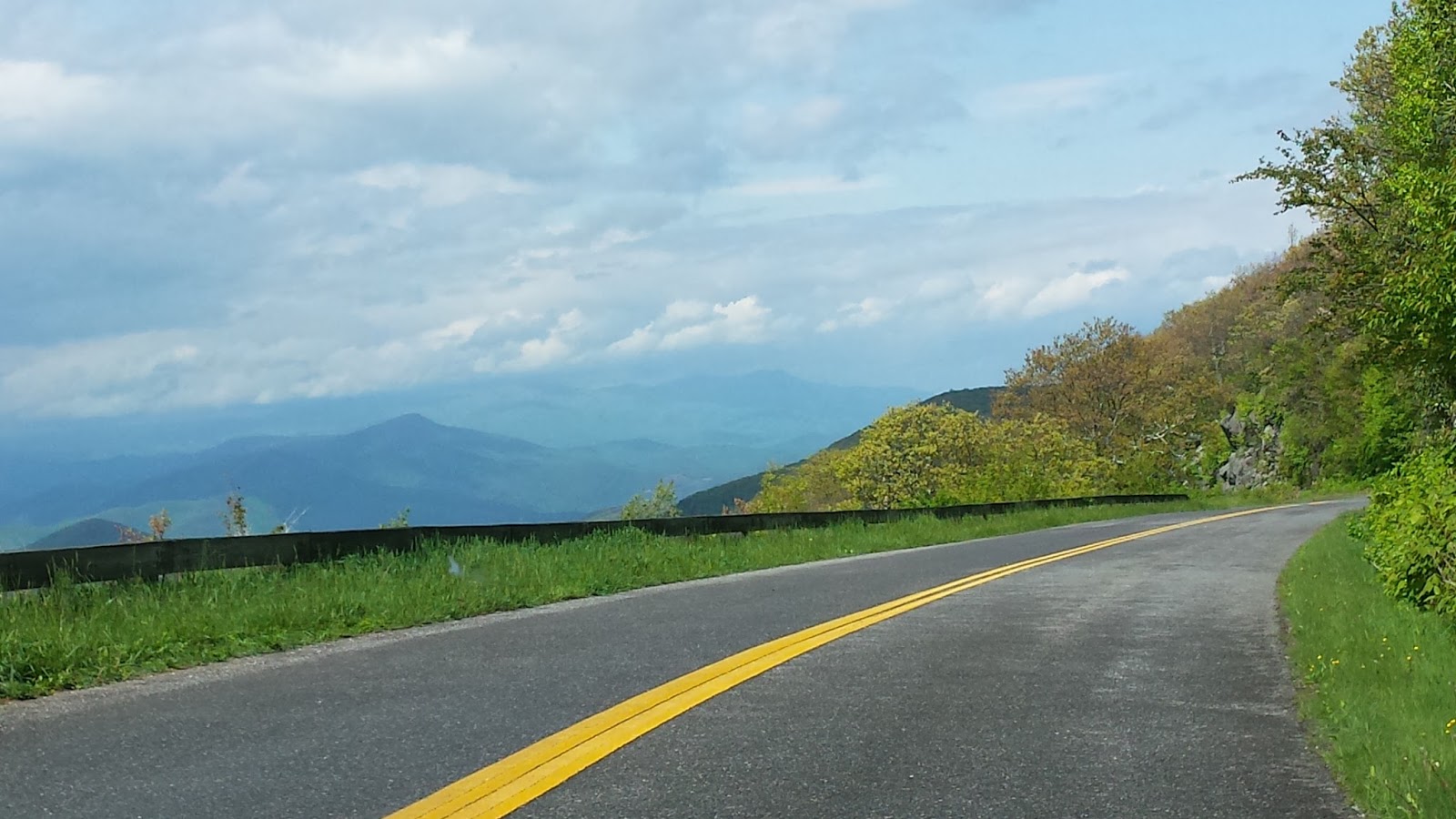
In all honesty, this is what the Virginia segment of the BRP looks like: trees.

We really, really like water crossings.

The trail down to Apple Orchard falls was really pretty, I'll give it that.

This is where we stopped, called it a waterfall, and hauled back up the trail.


Back on the road!

Onion Mountain overlook.

The colors this afternoon were unbelievable.

Most of it is trees. Then you come around switchback number kajillion and boom, a view.


We got really nice views into the valleys of Roanoke and Buena Vista.


Tunnel!


The quintessential Virginia image, to me, is a ramshackle barn in the middle of a field. They're everywhere!

CLOUD PORN. MOST BEAUTIFUL STORM IS BEAUTIFUL.

The lighting and the clouds were so gorgeous.

Look carefully: there's a hawk (I think?) circling against that cloud.


Day Two - TN & VA

Saturday, May 20

I am writing this from Rocky Knob Campground, off Mile Marker 167 on the Blue Ridge Parkway. There are like, four occupied sites at this entire campsite. It's so quiet!

I slept in a little bit at Grandma's, then ate mashed potatoes and apple cake for breakfast like a grownup. While Aaron and Aimee socialized, I locked myself in the bedroom and called Expedia and then Alamo about the duds of cars they'd given us, and arranged for ANOTHER car at the airport location.

At the airport, Aaron actually got to pick out his preferred rental, which is how we got Car #3, a Jeep Patriot, for all of 10 minutes until he asked to switch to Car #4, a BRAND-NEW Chevy Equinox. The airport staff were horrified at our Charleston experience and worked with us until we had the best car available. This thing is pretty swanky, not gonna lie. SEAT WARMERS. BACK-UP CAMERA. And not a push-button start, which I hate.

It took a while to settle on a car and then switch our gear, but we got back to Grandma's in time to meet Aaron's cousin Corey and (new!) wife Amy, then pile into Corey's truck with Aimee to go eat at Giovanni's Pizza. I am still working on that delicious calzone, and it was totally worth it. Don't tell my Fitbit. (Which is dying and we forgot both chargers and I AM FREE OF YOUR NAGGING, FITBIT!)

The drive into Virginia went really smoothly. It rained a lot (surprise...) but cleared up as we hit the Blue Ridge Parkway.

So far, Virginia is like a boring North Carolina? It took a while to hit the gorgeous views, but a lot of it is farmland and rolling pastureland, or tree canopies over the two-lane road. I feel enormous, piloting this boat down a road with no shoulders. But it's quiet and pretty, and we basically have this campground to ourselves.

It is also raining (...) and we're journalling and eating in the car, because why not. I applied seam sealer to the tent, so fingers crossed this time? It'll be an early sunset with this rain, so hopefully an early bedtime and then we can be well-rested and have the chance to properly de-stress after two awful weeks at home and work.

Also, my favorite horse won the Preakness. I know you all cared. WHOO!

The tiny "optional" third row in the Journey, accessed only by folding down the middle seat.

Getting started. Oh hey. Rain clouds.


These next few are our first real view from the Blue Ridge Parkway, around Rocky Knob.


Early season campground = empty.


These flowers grow on the trees overhead!

Mushrooms?

Day One - SC, NC, TN

Friday, May 20

This was not a good day.

It started with the Internet going out on Thursday night, and Friday morning, while finishing packing and reassuring the nervous dog, calling Time Warner and arranging for a tech to visit... while we were gone. Shout out to Chris for being an awesome person and keeping our animals  alive, AND agreeing to be there to meet the cable technician.

We had to swing by Mount Pleasant to get Aaron's car, and then he headed to Publix to give Krystel the key to dogsit (also much thanks to Krystel!) while I detoured to James Island to get another bottle of pain meds for Sheppy. While on James Island, dashboard lights came on our rental car (the Nissan Rogue), I noticed it needed an oil change in 600 miles, and it started beeping when I accelerated. So off to West Ashley to demand a replacement vehicle, which they couldn't give me fast enough.

5 miles down I-526 to meet Aaron in order to drop his car off at the airport, the 2016 Dodge Journey I was driving lit up to inform me that the right driver-side tire was at 23 psi and needed to be at 36.

Aaron filled up the tire with our air compressor while I stalked into Wendy's to get a root beer and spill said root beer on my wallet.

We dropped his car off without issue, finished logistics, and hit the road only about an hour delayed, but enough to enjoy the best of Columbia rush hour. Near the end of that, the same tire dropped to 28 psi.

Once upon a time, Sheppy and I went to stay in Charleston with Aaron when Athens was predicted to get a big nasty tornadic cold front full of super cells. When driving back afterward, I had to stop and turn around after my eyes exploded and I went blind for some reason. (It was like jalapeno juice, no exaggeration.)

We stopped at the next non-trafficky exit and pulled under a gas station overhang (because of COURSE it was raining) and managed to jack up the car, reinflate the tire, and run inside to buy non-inflammatory fix-a-flat. Also, dispose of the inflammatory stuff we had in the car repair kit. So that was another 30-45 minutes.

Just as we were leaving, two cars rear-ended each other at our exit. So there was another 30 minutes. We pulled over in a church parking lot to pray and I promptly freaked out because it was the exact same exit as the time I went blind.

Eventually, after definitely hitting the 3-5 miles of slow driving to evenly disperse the fix-a-flat, we were moving. And also stopping for gas in Spartanburg because the Journey gets the MPG of a boat.

We reached Bristol at 11pm, 11 hours after we got in the car at home. But in Bristol is Aaron's lovely grandmother who offered us a nice cozy room and food and sympathy. Also in Bristol was Aimee, who had left FIVE HOURS AFTER WE DID and got there 20 minutes before.

So that was day one. It was not a great day.

We didn't even take pictures.

Sunday, May 1, 2016

T-19 days!

2016: THE NORTHEAST (via a bunch of mountain ranges)

May 20: Bristol, TN
May 21: Rocky Knob Recreation Area, VA (via Blue Ridge Parkway)
May 22: Charlottesville, VA (and whatever's not burnt of Shenandoah National Park)
May 23: Seneca Rocks, WV
May 24: Finger Lakes region, NY (lodging still pending because NY sucks)
May 25: Green Mountains National Forest (VT) (via Adirondacks)
May 26-27: White Mountains National Forest (NH)
May 28: Fort Kent, ME
May 29-30: Acadia National Park, ME
May 31: Old Orchard Beach, ME
June 1: Charleston, SC

Probably about 90% resupplied. Car and flight reserved. Just need two more D batteries and some food for the car! And a place to stay in New York. Stop being a two-night minimum, no-online-reservations hassle, New York.

I have also looked back over this blog, noted our Lessons Learned and Items Forgotten, and they're written first on the packing list. I have also done more weather research and we're looking forward to two weeks in 60-degree weather, since it's now summer in South Carolina. May it not rain as much as last year.

Sunday, August 2, 2015

wrap-up

Three weeks later, we're mostly caught up on sleep deprivation and hygiene, every photo we've ever taken is on Facebook, we ordered prints of the good ones, Aaron got himself a job (!!), and today we finally put away the clean clothes from the trip and unpacked the rest of it. Like champs.

Gear:
Aaron has a High Sierra hydration pack; I borrowed a Deuter 28L daypack. It was more than enough space for what we needed for quick round-trip hikes. I don't want to give the Deuter back! Aaron carried the bulk of the immediate survival (water, bear spray, compass, knives) and I carried the extra clothes/rain gear, first aid kit, trail mix, phones/wallets/etc. It wasn't more than 10 pounds fully loaded, and we were really nicely balanced. As evidenced by how fast we booked it back down the Jenny Lake trail.

The tent, sleeping bag, lantern, and stove were all Coleman and like, 20 years old. Props to Coleman for having serviceable gear that is 20 years old. However, we gave it all away in Utah and Idaho. It's really heavy and bulky, and that is not okay for long trips or backpacking (which we'd like to eventually work up to). Modern camping gear is much more durable, smaller, and lighter.

Garmin Nuvi was a little drunk sometimes, but more or less got us where we needed to go. We confused her a lot in the mountains and desert. She tried to run us up the middle of nowhere on some dark, wet mountain in Colorado only once.

Rand McNally 2015 large-print road atlas was probably our biggest and most valuable navigational aid. We had state road maps for every state, but that atlas was just excellent. I think we used it more than the GPS in some parts.

America the Beautiful Access Pass was $80 and got us into every park free, no matter how many times we went in and out. Given our two entrances into Yellowstone and Grand Teton at $30 plus RMNP, it more than paid for itself. And somehow, while it's not technically supposed to, it also got us half off on all of our camping sites. More than paid for itself. Great little card. It's good for a year!

Darn Tough wool socks deserve every bit of praise anyone's ever sung about them. My feet were warm and dry no matter what I did to them, from Yellowstone steam to Rocky Mountain muddy tundra in the rain. We freaking love them. Go get some. They have a lifetime warranty!

My Merrell hiking shoes were badass and after a first hike to correct my pronation issues (thanks, sprained ankle), felt fantastic. No blisters, no soreness. They gripped their way up Ensign Peak and they even picked up trash on concrete. Aaron had Gander Mountain brand shoes, and he liked them about as much. Good shoes.

Clothing: WOOL CAPS were the best and we wore them almost constantly in Colorado. Ballcaps to keep rain off glasses. Water-resistant outer clothing. Leggings/compression shorts. Dri-fit inner clothing. And a big hoodie for coziness's sake.

Phones: T-Mobile and Sprint get absolute shit non-existent coverage past the Mississippi River. Screw that; we're switching to Verizon as soon as Aaron's contract expires in the next 30 days. Verizon gets much better service.


Lists:

Stuff We Forgot
  1. Aaron's clip-on sunglasses (but it rained the whole time, so moot point)
  2. Napkins (rectified at next fast food stop)
  3. Coozies
  4. Clips for closing snack food bags
  5. Laundry bag (got one from his mom) 
  6. Batteries for the big lantern
Stuff We Want For Next Time
  1. Canopy for over the picnic table/grill
  2. Better bedding in general 
  3. Good-quality lanterns
  4. Microfiber towels
Lessons Learned
  1. Aaron learned how to gear shift on mountains in an automatic transmission!
  2. TEST YOUR STUFF BEFORE YOU LEAVE
  3. The crap on the Grand Teton website about campsite reservations is a lie. Check Xanterra for reservations. Or sleep in Jackson, because there aren't a lot of woods for sleepin' in. Somehow.
  4. We actually function really, really, really well at about 6000-7000 feet ASL. We were rolling.
  5. Yellowstone is just Disney World and Old Faithful is Mickey Mouse.
  6. Idaho wants you to die and DOES get tornadoes.
  7. The campground at Craters of the Moon is open again!
  8. Paracord makes for a great laundry line when your stuff is soaked.
  9. Do not sleep in Kia Souls.
  10. Don't go out west during a strong El Nino.
License Plates We DIDN'T See
  1. Connecticut
  2. Hawaii
  3. Rhode Island
  4. Vermont
Bonus Plates
  1. Ontario
  2. Saskatchewan
  3. Alberta
  4. British Columbia
Animals Seen
  1. Elk, male and female
  2. Marmot
  3. Rabbit
  4. Squirrel
  5. Moose (female)
  6. Pika
  7. Bison (deeeefinitely male)
  8. Beaver
  9. Fox
  10. Enormous raven
  11. Owls
  12. Northern harrier
  13. Osprey
  14. Bald eagle
Rain-Canceled Plans 
  1. Great Smoky Mountain National Park hike (too wet for the scramble)
  2. Bridal Veil Falls (RMNP)
  3. Fairy Falls (YNP)
  4. Death Canyon (GTNP)
  5. Snowy Range scenic drive (Wyoming; it was under a mudslide and flash flood advisory)
  6. Craters of the Moon hike (ID)
  7. City of Rocks climbing (ID)

Bonus story: that time that a janitor at the Missouri welcome center asked if I would participate in the naked bike race, because I really should.


So with all that done... it's time to start working on 2016! :D We have to replace some gear over the year. Since El Nino will, in all likelihood, still be going by spring 2016, we are probably, most likely, going northeast, to Shenandoah NP and up the Appalachian Trail, basically. Niagara, upstate NY, New Hampshire and Vermont, and Acadia NP in Maine. Plan B is the Pacific Northwest to Montana, but that is a little harder logistically and a lot more expensive.

Whee! Thanks for reading!